Road bike route: Malaga -> Fuente de la Reina (Montes de Malaga) -> Puerto del Leon -> Olias -> El Palo > Malaga
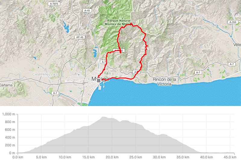
Distance: 45.96km
Elevation gain: 1125m
Elevation max: 934m
Road bike route description
A famous climb from Malaga to Fuente de la Reina and Puerto del Leon is appreciated by every cyclist. It is an almost 16km of ascent with 3 parts of 12% of gradient.
You have to follow the street Calle Victoria then Cristo de la Epidemia and then you will follow the signs Camino Colmenar. You are on the A-7000 road to Puerto del Leon. The surface is so cool and makes your effort efficient. There are amazing views and your legs are getting to be the weakest part of your journey. But after 16km you have it done !! A few small restaurants to get refreshed even the fountain next to Fuente de la Reina. Enjoy!
Go on and after 2km, turn right for Olias and El Palo through the MA-166 and then the MA-3111, later the A-7001. You need to go downhill 16km very fast and you can observe firstly a majestic peak Santopitar on the left side and then almost all time the Mediterranean sea. Nice 16km till a quarter El Palo, the part of Malaga. Then follow the signs to reach the city center.