Cycling route: Malaga > Campanillas > Los Nuñez > Almogia > Puerto de la Torre > Malaga
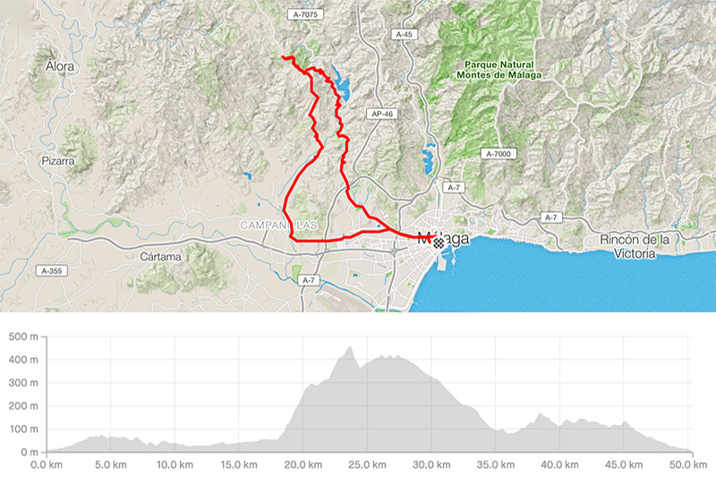
Distance: 50.39km
Elevation gain: 880m
Elevation max: 452m
Road bike route description
This is a short moderate route with only one 6km long but steep ascent. You will leave Malaga through the A-7076 till Campanillas where you keep straight passing the roundabout following the A-7058. Having seen 18km sign, turn left across the river and start climbing through Los Nuñez. There are some steep parts close to 18% but the surface is mostly good.
Once you reach the top, you have to go down to the crossroad and turn right through the MA-3402 enjoying 6 km long downhill along the lake El Casasola. If you need some water, enter Almogia. There is a fountain at the beginning of the village. Then, take the A-7075 to get some easy and short climbs before Malaga.
Entering a quarter Puerto de la Torre you are again in Malaga and keep on following the signs to the city center.