Cycling route: Malaga > Campanillas > Estacion de Cartama > Cartama > Alhaurin El Grande > Alhaurin de la Torre > Churriana > Malaga
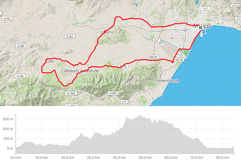
Distance: 84.48km
Elevation gain: 1015m
Elevation max: 341m
Road bike route description
It is a short and easy ride behind Malaga in the valley called Hoya de Malaga.
From the city take a direction for Campanillas / Pizarra through the A-7054. After 15kms in the city Estacion de Cartama turn left for Cartama / Alhaurin el Grande via the A-7057/MA-3404. At the beginning of the city Alhaurin el Grande take right for Coin, the road A-404 for a few kms and before Coin turn left following the A-355 back to Alhaurin el Grande. Go along the city on the road A-355/MA-3303/A-387 to Alhaurin de la Torre. It is almost all the time down and later go through Churriana to the airport.
Arriving to the highways in Churriana you have to go through one of them, so take the MA-21 where max. speed is limited to 80 km/h. Going along Malaga Airport for 2 km's turn right for the Port of Malaga. You will go along the west shoreline to the city center of Malaga.